
Dipper: GPS Area Measure
Measure land area with GPS or maps
Calculate field area, acreage, distance and perimeter on iPhone, iPad and Android. Outline a boundary on the map or walk it with GPS. Connect an external GNSS / RTK receiver when needed.
Previously GPS Area Measure: FieldOne.
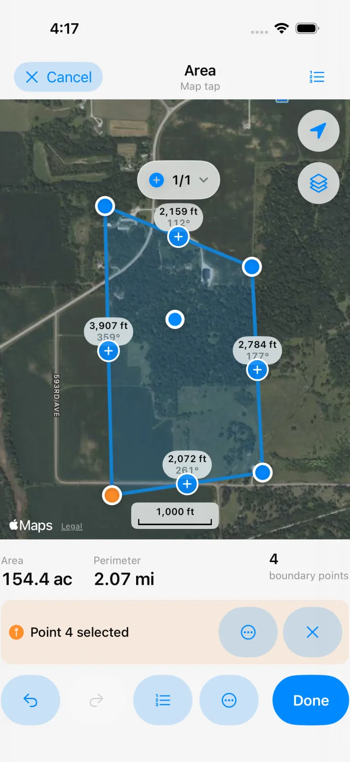

Measure area and distance
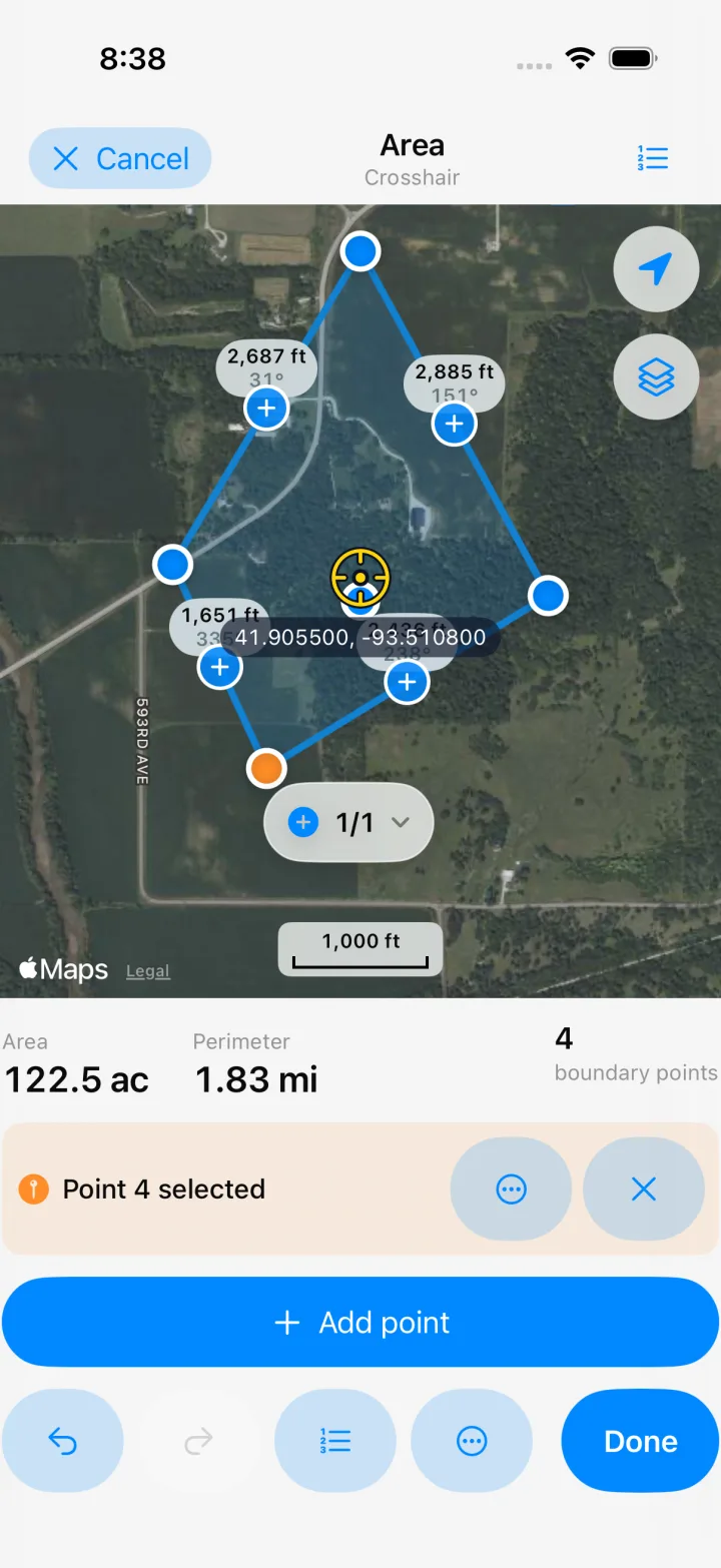
Place points by tapping the map or using the crosshair.
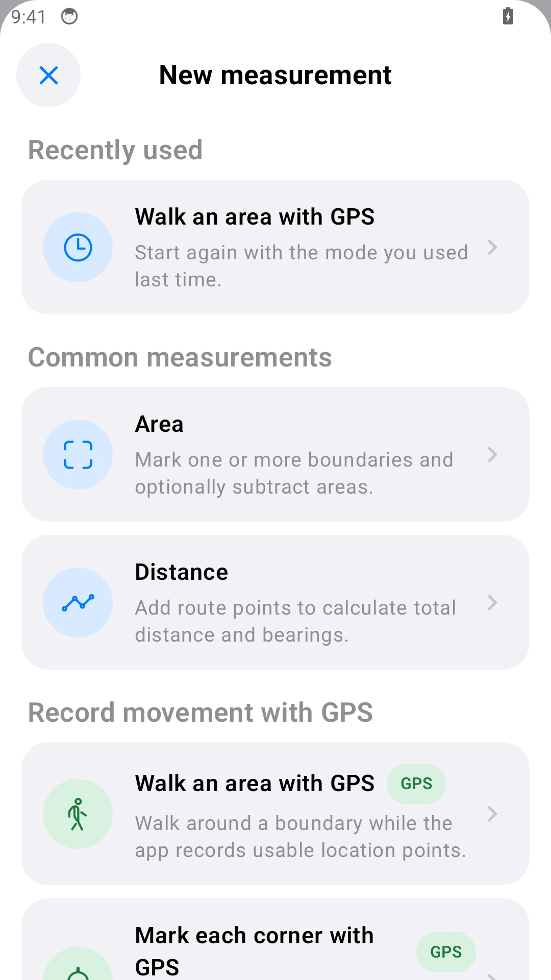
Common measurements
Area
Mark one or more boundaries and optionally subtract areas.
Distance
Add route points to calculate total distance and bearings.
Record movement with GPS
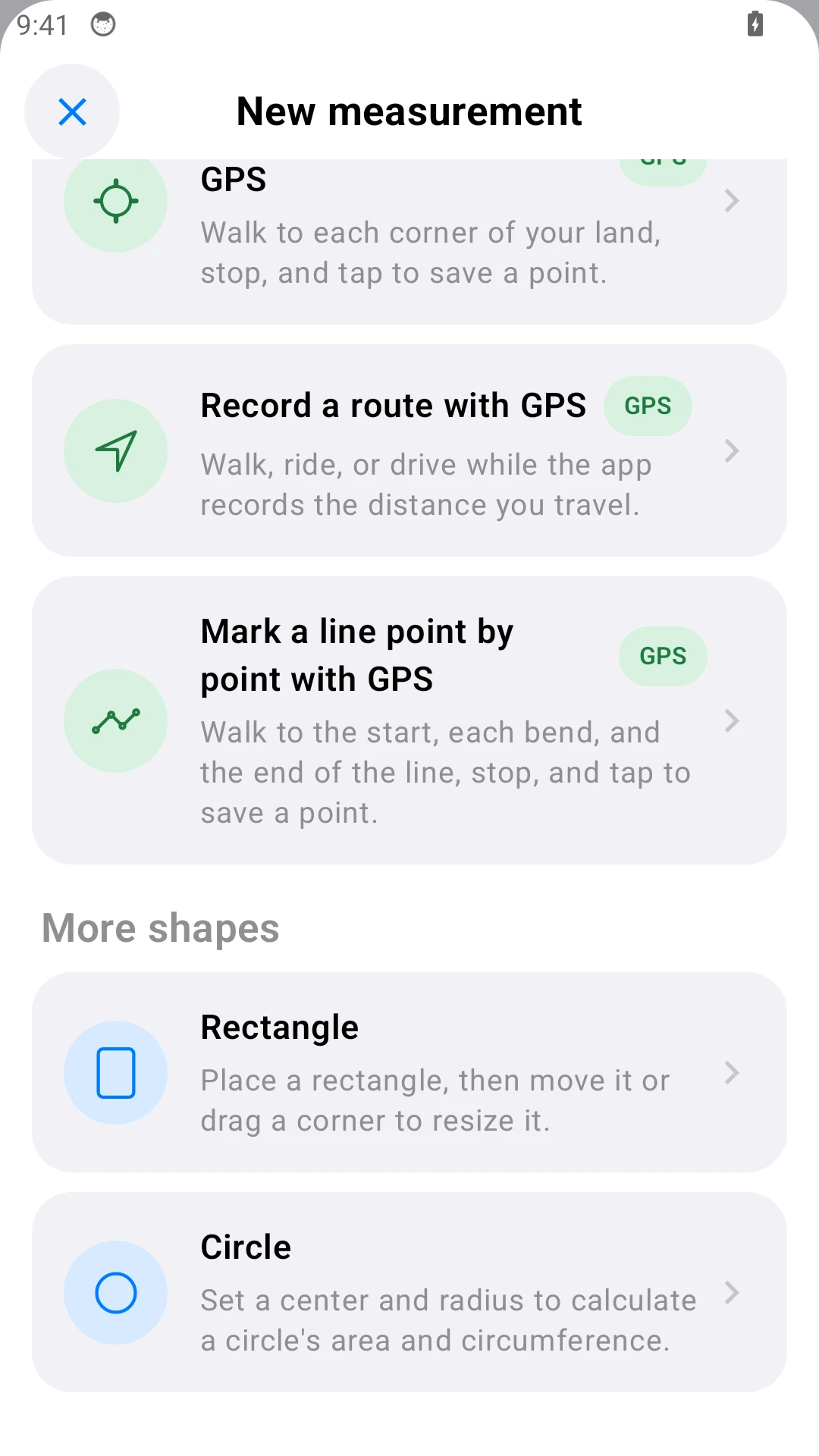
Walk an area with GPS GPS
Walk around a boundary while the app records usable location points.
Mark each corner with GPS GPS
Walk to each corner of your land, stop, and tap to save a point.
Record a route with GPS GPS
Walk, ride, or drive while the app records the distance you travel.
Mark a line point by point with GPS GPS
Walk to the start, each bend, and the end of the line, stop, and tap to save a point.
More shapes
Rectangle
Place a rectangle, then move it or drag a corner to resize it.
Circle
Set a center and radius to calculate a circle's area and circumference.
Which measurement method should I use?
| Method and use | Receiver | Internet |
|---|---|---|
| On the map Calculate area or distance from a visible boundary. | Not needed | Needed to load new map imagery. |
| Phone GPS Walk boundaries or record corners and routes on site. | Not needed | GPS positioning works offline. |
| GNSS / RTK Measure with the receiver’s position. | Required | Needed when the app relays NTRIP corrections. |
RTK needs correction data. A receiver with its own corrections does not need the phone online for corrections. Map imagery may still need internet.
Android phones and tablets
Measure land, edit boundaries, and export reports on Android.
See it in action
Short clips, real app — no mock-ups.
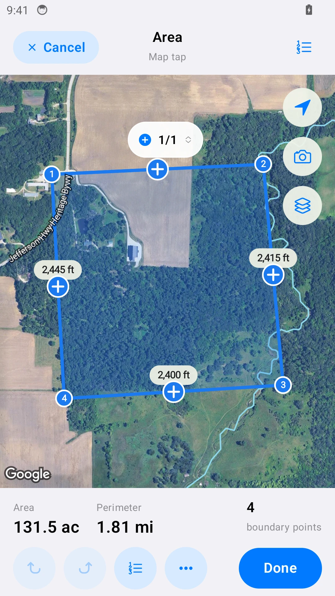
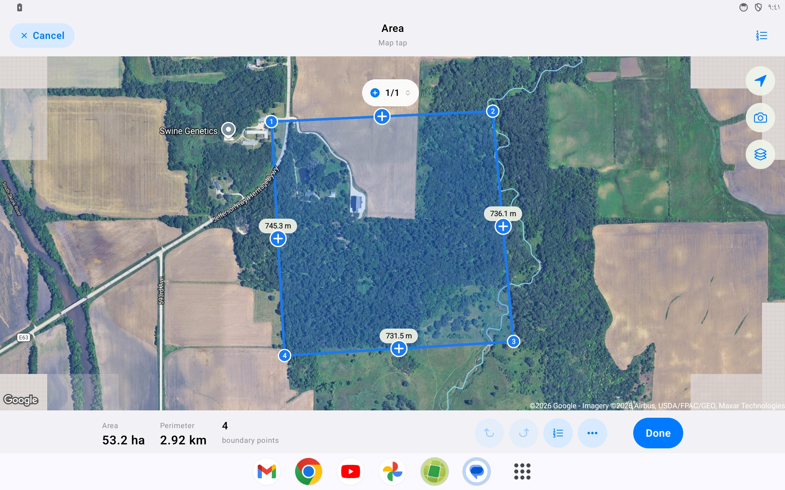
Tap corners on the map — area, perimeter, and per-edge distances update live.
Open a saved measurement and export a PDF report, KML, GeoJSON, or GPX in two taps.
Measure circles and rectangles.
Standard, satellite, and hybrid maps. iOS: Apple or Google Maps. Android: Google Maps.
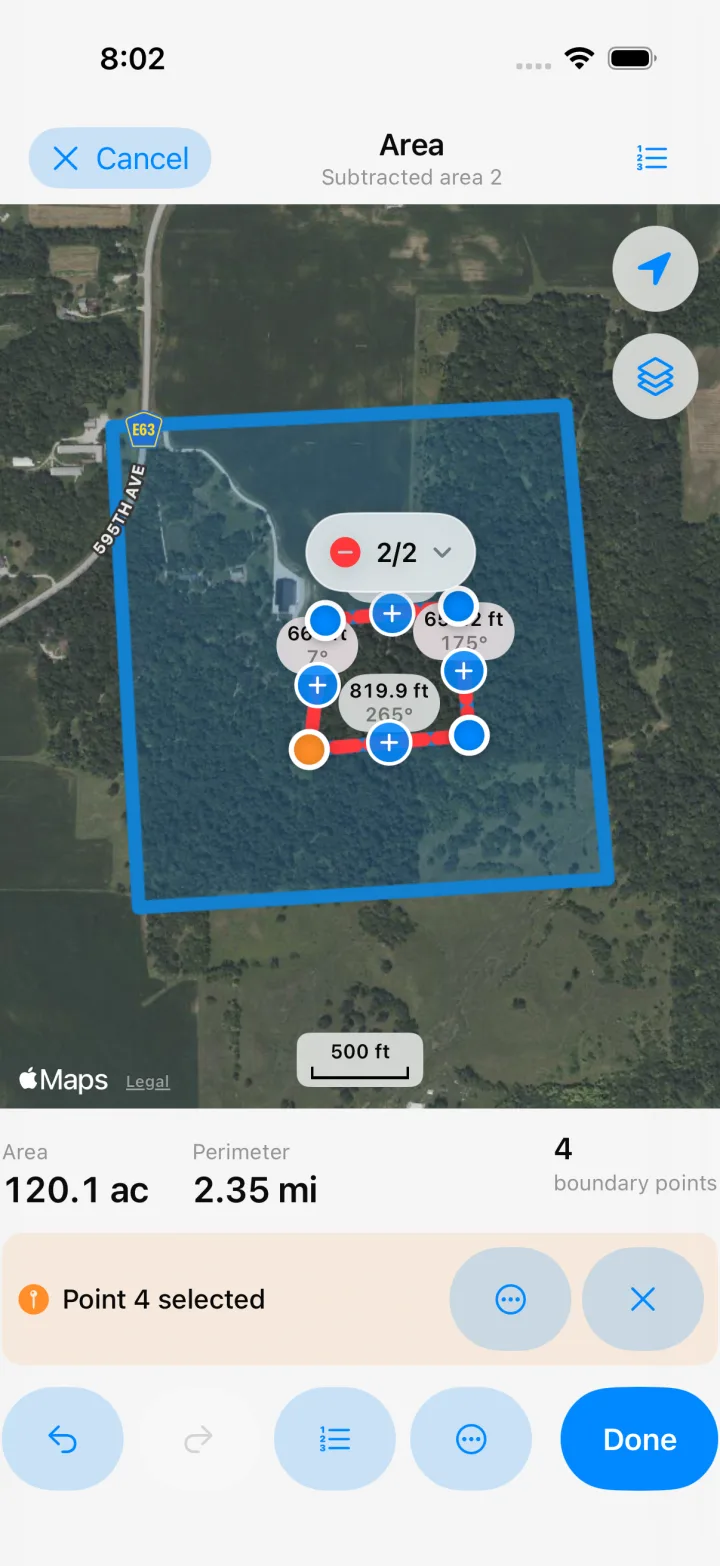
Multiple regions and interior cutouts — subtract ponds or buildings to get net area.
External GNSS / RTK receivers
Connect a receiver over Bluetooth LE or Wi-Fi. Check its fix status, accuracy estimate and correction age. The sky plot shows satellite positions and signal strength.
To relay RTK corrections through the app, you also need an NTRIP account and internet on the phone.
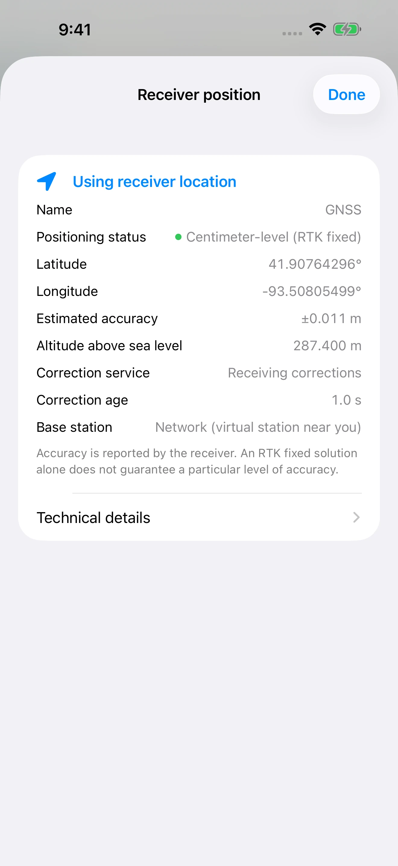
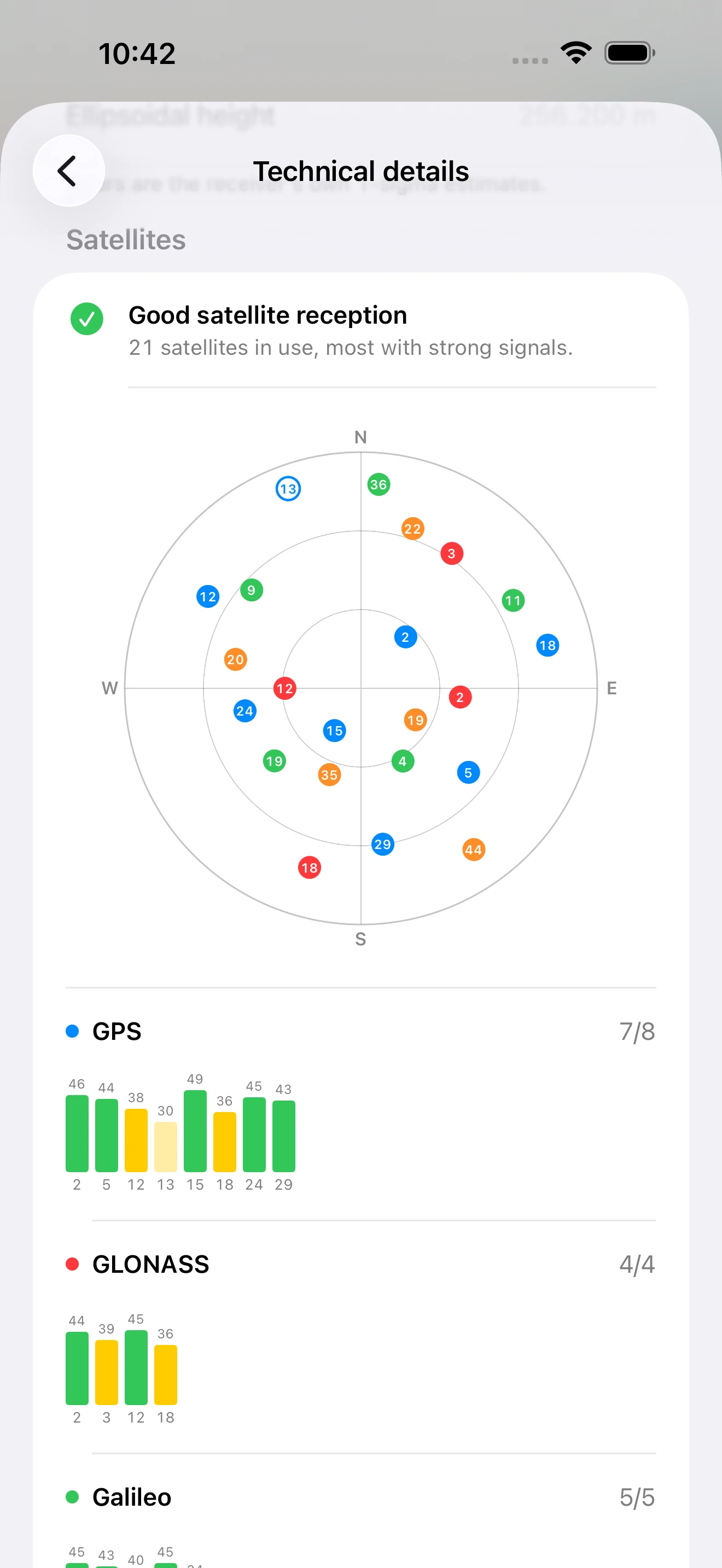
Actual app screens with demo data. Tap a screenshot to enlarge it.
Features
Transparent accuracy
Every GPS result includes an uncertainty estimate (±) based on the actual fix quality. A phone is not a centimeter-level survey instrument.
Geodetic calculations
Area and distance on the WGS84 ellipsoid. Combine regions or subtract excluded areas.
Your units
Acres, hectares, m², ft², plus regional units. Tap any result to switch units in place.
Fix it afterwards
Drag any vertex with a magnifier loupe, undo and redo freely, and get warned live if the shape crosses itself.
Keep measurements organized
Collections, tags, favorites, photos on every measurement, search, and a 30-day recycle bin.
Import & export freely
KML, GeoJSON, and GPX go both ways — bring measurements in from other tools and take yours anywhere. DXF exports keep each point's height for CAD.
Frequently asked questions
A few practical answers before you measure.
Can a phone measure land area accurately?
It is useful for planning and field estimates. Accuracy depends on the device, sky view, signal conditions, and how points are collected. The app shows an uncertainty estimate (±), but it is not a legal survey.
Does GPS work without an internet connection?
GPS positioning works without an internet connection. Map imagery usually requires internet; previously cached imagery may sometimes remain visible, depending on the map provider. Centimeter-level RTK is the exception: its corrections arrive over the internet, so the phone needs a connection for as long as you measure, unless the receiver has a correction source of its own.
How do I measure acreage?
Tap the boundary corners on the map, use the fixed crosshair, or walk the boundary with GPS. The app calculates area, distance, and perimeter as you work.
Can I export my measurements?
Yes. Export a measurement or collection as PDF, DXF, KML, GeoJSON, or GPX for reports and use in other mapping tools.
Is this a legal land survey?
No. Dipper is for planning, field notes, and estimates. For legal boundaries, construction, conveyance, or other high-stakes work, use a licensed land surveyor.
How can I measure a field without hiring a surveyor?
Walk the boundary with GPS, or tap the corners on satellite imagery. For a field boundary, averaged corner points typically land within a few metres — enough for seeding rates, fencing, spraying, or rent calculations. Hire a surveyor when the number has to hold up legally.
How do I calculate roof area from satellite imagery?
Trace the roof outline on satellite view to get the footprint area. Keep in mind that satellite imagery gives you the flat, top-down area: a pitched roof's actual surface is larger, so multiply by the pitch factor before ordering materials.
How much fencing do I need to enclose a property?
Measure the perimeter, not the area. Trace the boundary on the map or walk it with GPS — the app shows the total perimeter plus the length of every individual segment, so you can order per run and allow for gates.
How do I measure land with an irregular shape?
Add as many boundary points as the shape needs; there is no limit. Place extra points along curves to follow them closely. If a pond, building, or excluded strip sits inside the parcel, use an interior cutout to subtract it and get the net area.
What should I look for in a free land measuring app?
Four things worth checking: that you can export your own data without a subscription, that it reports an accuracy range instead of claiming centimetre precision, that GPS positioning works without mobile data or Wi-Fi, and that ads do not cover the map while you tap. Dipper does all four; some other apps do some of them.
How accurate is phone GPS compared with professional survey equipment?
A modern phone under open sky usually resolves to a few metres. Survey-grade RTK GNSS resolves to centimetres. That gap barely matters when estimating a ten-hectare field and matters enormously for a property line, which is why the app shows its own uncertainty range on every result.
Can the app measure to the centimeter?
With a suitable external RTK receiver, current corrections and a stable fixed solution, positioning can reach centimeter level. Connect the receiver over Bluetooth LE or Wi-Fi. When the app sends NTRIP corrections, the phone needs internet throughout the measurement; a receiver with its own correction source may not. Conditions and receiver setup affect accuracy. Phone GPS alone is generally meter-level. See the help center for setup and accuracy guidance.
Which GNSS receivers work with the app?
Any receiver that outputs standard NMEA 0183 over Bluetooth LE or Wi-Fi (TCP). iPhones cannot use classic Bluetooth (SPP) receivers. For RTK, choose a multi-band receiver that accepts RTCM 3 corrections on the same connection; GST, GSA and GSV output add the accuracy estimate and the sky plot.
Where do I get an NTRIP account for RTK corrections?
Many countries, states and provinces run government or university RTK networks (often called CORS), frequently free after registration: search for the RTK or CORS network in your region. Commercial RTK services sell monthly or yearly subscriptions, usually with wider coverage. You can also run your own base station. The service gives you a caster address, port, username and password to enter in the app. A base station within about 20–30 km gives the fastest, most reliable fix.
Common problems, solved
“Want to export your own data? Some apps require a subscription first.”
PDF, KML, GeoJSON, and GPX export are included — your data stays portable.
“An ad banner over the map, right where you’re tapping.”
No ads, no account, no pop-ups — every measuring tool here is free to use.
“Claims centimeter accuracy, then the boundary drifts across the road.”
Poor fixes are filtered, corner points are averaged, and every result shows its uncertainty range.
“One mistap and an hour of walking is gone.”
Drafts autosave continuously, undo and redo work everywhere, and deleted items rest in a 30-day recycle bin.
Professional reports
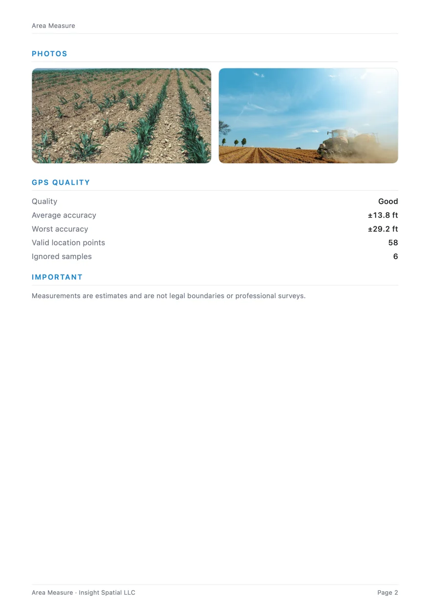
Every measurement turns into a clean PDF report: an annotated satellite map, results with an uncertainty range (±), coordinates, and your photos and notes. Collections export as a combined report with numbered maps.
Files open directly in QGIS, Google Earth, and handheld GPS units — and GPX goes both ways, in and out.
PDF · KML · GeoJSON · GPX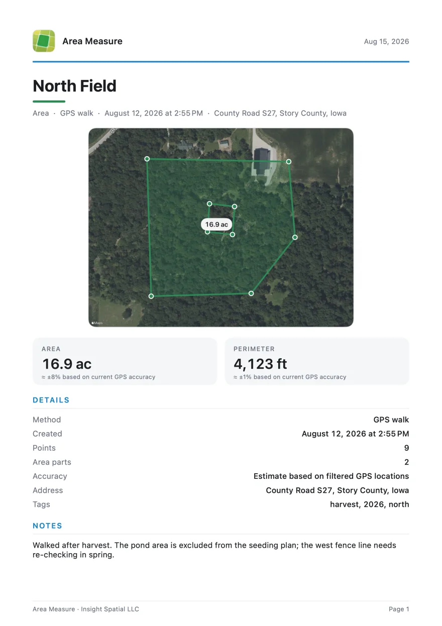
Accuracy and responsible use
Know what the measurement means
Dipper provides planning and field estimates. GPS accuracy varies with the device, sky view, signal conditions, and collection method. The app is not a substitute for a licensed land survey, legal boundary determination, or professional surveying equipment.
Verify important boundaries and measurements with a qualified professional. Map imagery and place data come from the map provider you select and remain subject to that provider's terms.
Our promise
Practical guides
About us
Dipper is developed and maintained by Insight Spatial LLC. We keep the app and its guides up to date. For questions or feedback, use the support email below.
Company websiteUpdated
Support
Questions, bug reports, or feature ideas? Email us:
measure_support@insightspatiallabs.com
For bug reports, include your device model, operating system, and app version.