 Area Measure
Area Measure
Area Measure
Map out fields, walk boundaries with GPS, and get area, distance, and perimeter with a transparent accuracy estimate — right on your iPhone or iPad.
Pick the method that fits the field — switch anytime.
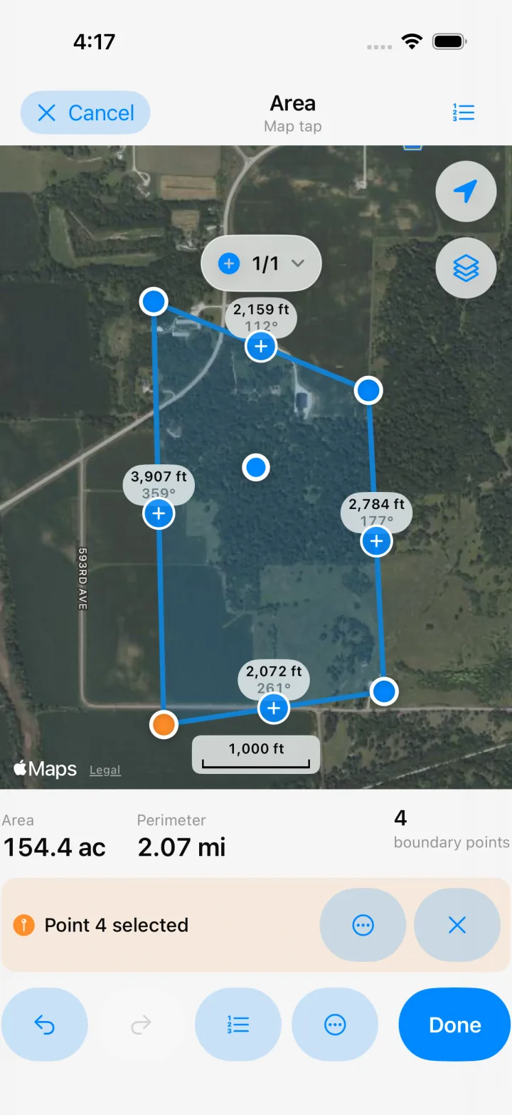
Tap each corner on satellite imagery. The fastest way when you can see the boundary.
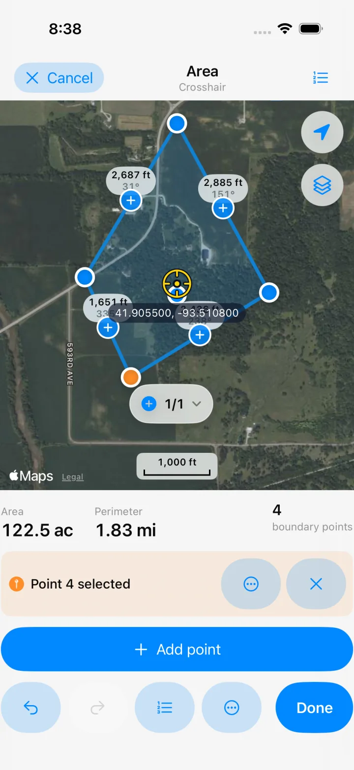
Pan the map under a fixed reticle and drop points exactly where you want them.
Walk around the field while smart filtering keeps only usable GPS fixes.
Stand at each corner and capture an averaged GPS point. Best accuracy for regular fields.
Walk, ride, or drive while the app records the distance you travel.
Short clips, real app — no mock-ups.
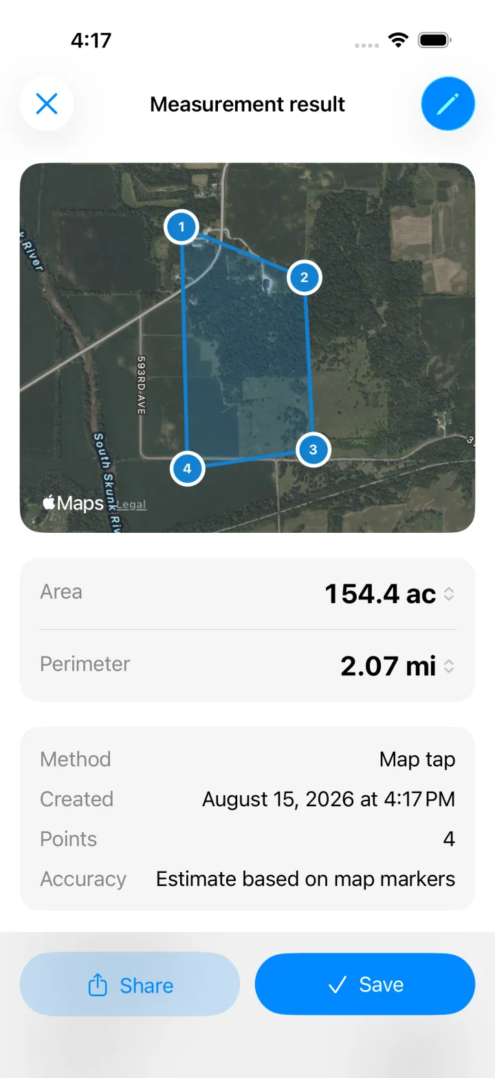
Tap corners on the map — area, perimeter, and per-edge distances update live.
Open a saved measurement and export a PDF report, KML, GeoJSON, or GPX in two taps.
Circles, rectangles, and line corridors for the shapes a polygon can't catch.
Every GPS result carries a ± estimate derived from the actual fix quality. No pretending centimeters from a phone.
Geodesic math on the WGS84 ellipsoid, multiple regions with true holes, circles, rectangles, and corridors.
Acres, hectares, m², ft², plus regional units like 亩 and 坪. Tap any result to switch units in place.
Drag any vertex with a magnifier loupe, undo and redo freely, and get warned live if the shape crosses itself.
Collections, tags, favorites, photos on every measurement, search, and a 30-day recycle bin.
KML, GeoJSON, and GPX go both ways — bring measurements in from other tools and take yours anywhere. Never paywalled.
“Want to export your own data? That’ll be $40 a year.”
PDF, KML, GeoJSON, and GPX export are free forever. Your data was never ours to sell back to you.
“An ad banner over the map, right where you’re tapping.”
No ads, no account, no upsell screens — the whole app is the free version.
“Claims centimeter accuracy, then the boundary drifts across the road.”
Bad fixes are filtered out, corner points are averaged, and every result states its honest ± range.
“One mistap and an hour of walking is gone.”
Drafts autosave continuously, undo and redo work everywhere, and deleted items rest in a 30-day recycle bin.
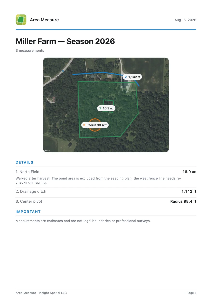
Every measurement turns into a clean PDF report: an annotated satellite map, results with their honest ± uncertainty, coordinates, and your photos and notes. Collections export as a combined report with numbered maps.
Files open directly in QGIS, Google Earth, and handheld GPS units — and GPX goes both ways, in and out.
PDF · KML · GeoJSON · GPX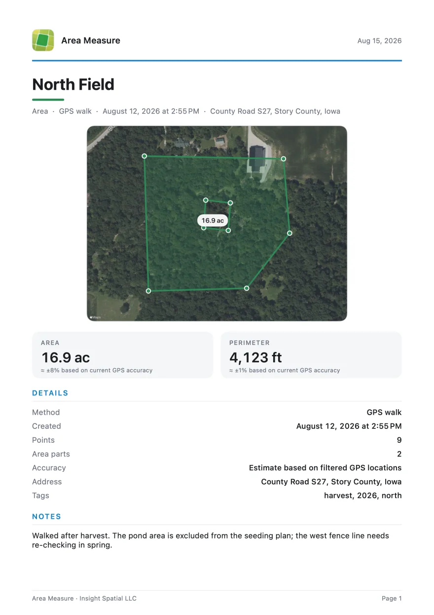
Questions, bug reports, or feature ideas — email us and a human will reply:
areameasure@insightspatial.app
Please include your device model and iOS version for bug reports. Emails in English or 中文 are both welcome.